Sunday, July 1, 2018

Glacier, the Bitterroots, Craters of the Moon, and the Snake 2018

To celebrate my parents' fiftieth wedding anniversary, I traveled with my extended family to Glacier National Park in June.  We stayed on the west side, and since the Going-to-the-Sun Road was not open beyond Avalanche, we focused our activites on the Lake McDonald area.

One day, a few of us hiked up to Avalanche Lake.  It was a lovely hike with Varied Thrushes singing in the background.  An American Dipper even made an appearance at the lake.


One of the highlights of walking to through the woods is the occasional surprise orchid.  I found my first White Lady's Slipper along a path to the Apgar campground.


After the family portion, I went to visit my best friend from first grade who now lives in Boise, ID, by way of the the Bitterroot Mountains along the border of Montana and Idaho.  I always assumed that "bitterroot" described the mountain range since it presented a formidable challenge to the Lewis and Clark "Corps of Discovery" expedition.  In fact, the mountains are named for a lovely wildflower.  I found a patch of bitterroots at the National Bison Range.


Further along the way to Boise, I stumbled onto a national park that I had not yet heard of - Craters of the Moon National Monument.  It was a facsinating geological oddity along the Great Rift in the valley of Pioneer Mountains of Idaho.

  
One of the highlights of Craters of the Moon was exploring the lava caves with a ranger.  The hot summer temperatures gave way to cool cave air.  One of the caves had ice, and I could see my breath.
    

My friend and her wife gave an excellent tour of Boise.  One of my favorite stops was an overlook of the Snake River where we watched the aerial displays of several Prairie Falcons for an hour.


The trip ended back at Glacier in Montana, just as the Going-to-the-Sun Road was opening.  The road was clear, but the fog prevented much sightseeing.  On a hike to Hidden Lake that required slow and steady steps atop a foot of snowpack, visibility was limited to about 50 yards, adding to the sense of isolation and mystery.  Occasionally, the fog would lift to reveal a beautiful meadow pond or the caravan of hikers ahead and behind.  But I never did see the "Hidden Lake." 


Sunday, September 10, 2017

Isle Royale National Park 2017

After a six-hour voyage aboard the Ranger III, Isle Royale National Park came into view.  It's an isolated island in Lake Superior with a Michigan address.  The Ojibwe call Lake Superior gichi-gami, meaning "the Great Sea."  

Twelve years ago, we hiked 40 miles from Windigo to Rock Harbor on the Greenstone Ridge trail.  I remember thinking then that it is as much a place for paddling as for hiking.  So, this return trip would involve "expedition kayaking," which means packing everything we would need for seven days and six nights in a 17-foot sea kayak.


Upon arriving at Rock Harbor, we decided to paddle out to Merritt Lane.  The waters along the shore were choppy.  A couple of brothers in their 60s felt that the water was too rough, so they headed back.  We set up camp in a lakeside shelter and ate dinner by 6:00 p.m.  The brothers Tim and Frank showed up at 8:30 p.m., having paddled the calmer waters of Tobin Bay. 

In the morning, there was trouble.  Tim discovered his younger brother partially lying in the lake.  Hearing Tim's call for help, we rushed to pull Frank up from the shore.  He was visibly shivering and unable to move his limbs.  He also could not speak.  We treated him for hypothermia and then paddled back to Rock Harbor for help while Tim stayed to care for Frank.

Ranger Marshall Plumber responded swiftly in a Bertram motorboat called the Lorelei.  We learned later that Frank was airlifted to Thunder Bay and was treated for a stroke.  In light of the medical emergency, we adjusted our plans and stayed at Merritt Lane another night.

The next day we got an early start to round Blake Point, the eastern tip of Isle Royale with notoriously rough waters.  We encountered some heaving, but nothing we hadn't already experienced on Lake Michigan.  

On the "north shore" of the island, we paddled past some palisades and through a bit of open water of Lake Superior.  Eventually, we received some protection from a few outer islands.  We stayed in a shelter at Belle Isle and heard the most amazing chorus of loons calling in the wee hours of the night.  The next morning, we were treated to a beautiful sunrise.  


We paddled leisurely through Lane Cove, then took the long way around to Five Finger Bay and portaged into Duncan Bay.  

In the morning, we spotted a beaver as we prepared to head up the bay to the Duncan Narrows.  It started raining, but our wetsuits kept us warm.  We made good time, and the rain stopped, so we decided to try to go around Blake Point a day early.  It seemed calm enough.

The rain returned, and the wind picked up behind us from the west, pushing us into the palisades.  The swells increased as we rounded the tip of the island, becoming bigger than anything we previously experienced.  We tried to stay at least a half-mile from the rocky shore.  The water was like an ominous slow-moving roller coaster with high peaks and deep troughs.  Better to ride than to fight them.  

After we cleared the point, we needed to find the safest way back to Merritt Lane.  Now, we were facing the wind, and water was breaking over the gunwale into the cockpit.  With wind and rain gusting into our eyes, we could only see waves crashing on rocks ahead of us.  Instead of navigating an uncertain maze of smaller islands, we tacked right toward the familiar shore.  It was the right choice.  

Later, we learned how lucky we were.  The Voyageur II, a 65-foot water taxi, refused to leave dock the day we rounded Blake Point to avoid the 10-foot swells.  I would not have chosen to paddle on those conditions on purpose.  There are numerous shipwrecks around Isle Royale, and the waters of Lake Superior have claimed much greater vessels, like the Edmund Fitzgerald.  We avoided a bad outcome on account of the Klepper kayak's seaworthiness, our general experience of paddling open water for more than 10 years, and keeping calm in the midst of the storm.  I would not rule out a little divine intervention, as well. 

The nasty weather brought some interesting visitors to the Merritt Lane campground.  We saw a river otter picking at a duck carcass near the lakeshore, and a juvenile sandpiper called a Lesser Yellowlegs was feeding at the puddles.  I also think we saw the flash of a marten. 


Isle Royale can be a peaceful place.  One day, we got in the kayak and meandered through the archipelago near Blake Point and ate lunch in the boat as we bobbed in the water.  Red-breasted Mergansers seemed to be around every corner.  Common Loons and Bald Eagles showed up at least once a day.  

Back at Rock Harbor, we stayed at the lodge for a slow reintroduction into civilization.  Our room had a south-facing balcony overlooking Lake Superior.  Having just finished reading Nevada Barr's A Superior Death in the wilderness, it was necessary to honor the protagonist Ranger Anna by purchasing some Snickers candy bars at the camp store, as well as some other treats.  On the night we attended Ranger Kelly's program about the northern lights, we enjoyed a glorious full moon in a partly cloudy sky, but alas, no Aurora.  And even though there are about 1,600 moose on Isle Royale, we only saw one.           
    

One of the highlights near Rock Harbor is the spruce bog on Raspberry Island.  We saw at least 100 pitcher plants in bloom with tiny sundew plants nearby.  Both carnivorous species were visible from the boardwalk.  It was so exciting to be there that we walked the trail twice.  

Isle Royale was an exciting and relaxing place to be this year.  We had two major challenges, but they made us aware of our blessings.  I am definitely willing to return someday.  Here's a video postcard from Isle Royale National Park.


Friday, June 30, 2017

Acadia and Beyond 2017

When I was a kid, I wanted to live in Maine, and this year I took one step toward that dream by finally visiting Acadia National Park.  To get acclimated from the Midwest to the North Atlantic coast, we rented a kayak to paddle at the Parker River National Wildlife Refuge on the border of Massachusetts and New Hampshire.  


Afterwards, we stopped to hike a loop trail through the woods and salt marsh of the Rachel Carson National Wildlife Refuge in southern Maine.  The Pink Lady's Slippers were blooming.


After a lovely backyard lobster dinner with Deb and Gary, the parents of a neighbor, we drove to Stonington and took a ferry to Isle au Haut.  We rented bikes for the day and explored the island.  I had a lobster roll for lunch on National Lobster Day with a tremendous view!


On a nicely paved road, it would have been possible to speed past the smaller stuff.  Since the road at southern end of Isle au Haut has alternating boulders and pot holes, I discovered a Dragon's Mouth Orchid in a high-quality bog during a pit stop. 


I don't think you're allowed to visit Maine without seeing a lighthouse.  Here's the Bass Harbor Head lighthouse.


When the weather turns nasty and the sea starts churning, you can see why lighthouses helped save so many lives.  I really like a stormy day, preferrably from the safety of solid ground.    


My relatives from Connecticut came up to Acadia for the weekend.  We went hiking, sightseeing, and paddled on Father's Day.  We saw some harbor seals from our kayaks.  I love the view of the coast from the water.   


Here's a video postcard I made of this trip to Acadia and beyond. 


Thursday, September 8, 2016

North Cascades 2016

For the centennial of the National Park Service, I decided to avoid the crowds and go to one of the less visited parks in the system.  North Cascades National Park in Washington State is the fourth least visited, behind Gates of the Arctic (AK), Lake Clark (AK), and Isle Royale (MI).


Not far from Seattle, North Cascades is a remote jewel.  My trip to the Stehekin valley required a four-hour boat trip up 55 miles of Lake Chelan.  North Cascades boasts the most number of glaciers in the contiguous U.S., but even these are disappearing at an alarming rate.

Meltwater from glaciers and snowfields produces a myriad of cascading creeks, streams, and waterfalls that supply the park with its namesake.


The trip focused on two multi-day backpacking itineraries.  The first was along the South Fork Agnes Creek Trail to the Suiattle Pass and back.


This first portion of the trip followed part of the Pacific Crest Trail (PCT) through the Glacier Peaks Wilderness managed by the U.S. Forest Service.  Numerous PCT "through-hikers" put me to shame.  Most of these hikers were younger than I by 15-20 years.  More like elves than humans, I'm not sure their feet were even touching the ground.  Having started the 2,659-mile PCT in Mexico in spring and traveling 25-35 miles a day, the through-hikers I met were less than 90 miles from their final goal in Canada.  I was content to hike my forty miles in four days.


One of the highlights on the trail to Suiattle Pass was being able to hear and see several pikas.  Living amid the rocks above treeline, pikas are being challenged by climate change.  Last year at Glacier NP, I did not see or hear any pikas.  At North Cascades, they seemed to be showing off!


The second itinerary was to the Park Creek Pass and back.  Since the PCT veers northeast, this portion was much quieter.  On this trip, I covered thirty-five miles in three days.  The most difficult part was the 1,000-ft rise in one mile from Park Creek Camp to Two Mile Camp.  But the challenge was worth it.  Majestic views of Mount Booker and Mount Buckner encouraged me to press on to the pass.    


The alpine meadow just south of Park Creek Pass was especially lovely and worthy of a root beer barrel stop.  Like a prairie, pictures cannot convey the intimate quiet beauty of a meadow.  The surrounding mountains, however, provide a mighty frame for the high altitude fields with colorful alpine wildflowers.  


After enduring challenges on the trail, the little village of Stehekin provided many comforts.  With views of beautiful Lake Chelan, rooms at the North Cascade Lodge were very comfortable.  Karl Gaskill sells fresh organic vegetables and homestyle goat cheese at The Garden.  High marks go to the Stehekin Pastry Company, which specializes in homemade cinnamon rolls and sticky buns, filled savory croissants, breads and cookies, and my personal favorite - Robbie Courtney's special "egg-in-a-biscuit."  Stehekin means "way through" but to me, it means rest and relaxation.


Tuesday, April 26, 2016

Southernmost Illinois Spring 2016

Spring comes to southernmost Illinois a few weeks earlier than the northeastern corner where I live.  Itching for some hiking and paddling, I planned a trip to the Shawnee Hills and Cache River basin.  The landscape of southern Illinois is unique because it lies at the convergence of four physiographic provinces: coastal plains (south), Ozark plateau (west), low interior plateau (east), and the central lowlands (north).

The trip involved camping in the Crab Orchard National Wildlife Refuge.  Most wildlife refuges do not permit camping, but there are 8 campsites on Crab Orchard's Devil's Kitchen Lake.  The blossoming dogwoods laced the forest.  It rained a lot the first night, but I love the sound and smell of rain when I am tucked in a dry tent and warm sleeping bag.

The bird sightings at Devil's Kitchen were fantastic.  Among 40 species I observed in the campsite, the highlights were common loons, osprey, pileated woodpecker, summer tanager, eastern whip-poor-will, barred owl, and great horned owl.


A morning hike at Ferne Clyffe State Park yielded otherworldly rock formations covered with ferns.  Again, the birding was excellent, including black vulture, wild turkey, Louisiana waterthrush, and several other warblers.  Best bird species was a pair of worm-eating warblers.  The wildflowers were also spectacular, including mayapple, squirrel corn, dwarf larkspur, and jack-in-the-pulpits.  There was even a morel mushroom on the trail.  


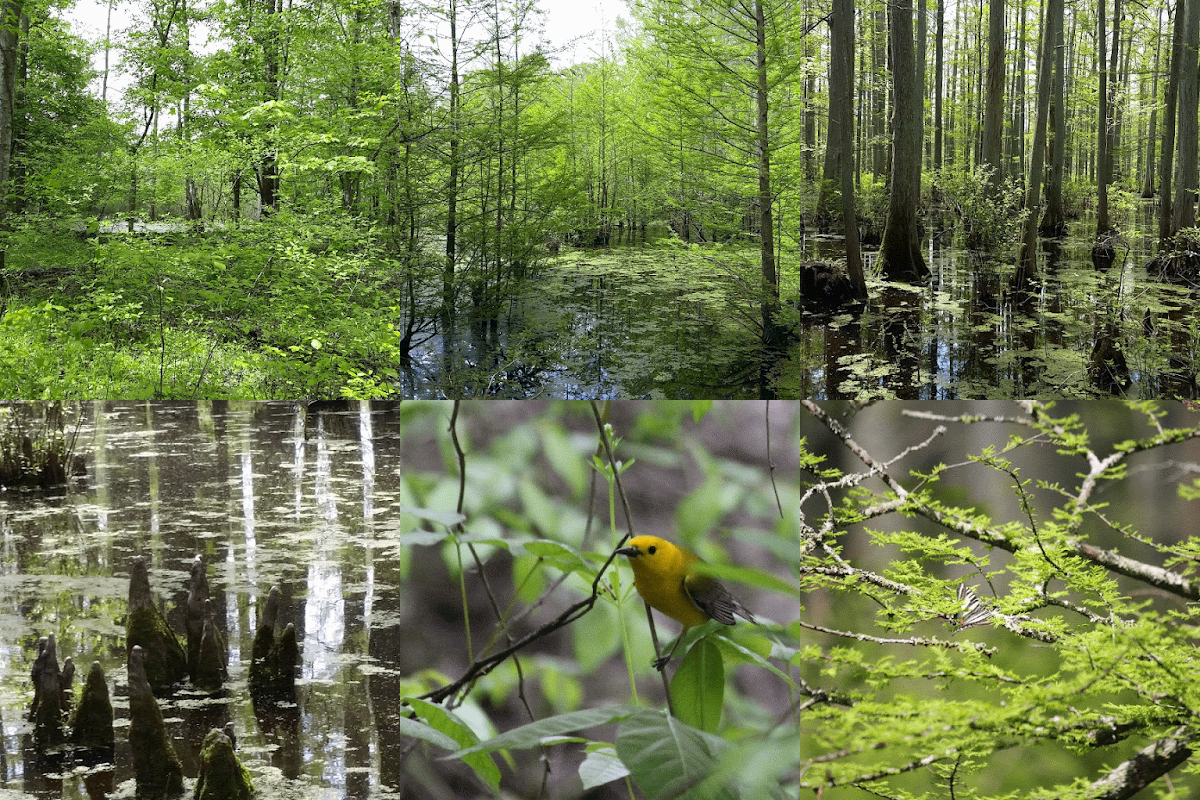
One of my favorite places in the Cache River basin is Heron Pond Nature Preserve, a national natural landmark.  A short walk along the river leads to a secluded cypress paradise.  Best bird was the white-eyed vireo, which I initially misidentified by ear as gray catbird.  It was competing for attention with a flurry of prothonotary warblers.  The visit to Heron Pond was part of an outing with the Illinois chapter of the Nature Conservancy.  Two venerable retired IDNR staff reminisced with our group about acquiring this special place to protect it.           


The activities concluded with a canoe trip through the Buttonland Swamp of the lower Cache River, which has been the home of Illinois' champion bald cypress tree for over 1,000 years.  The Cache River watershed contains 91% of Illinois' high-quality swamp/wetland habitat and is recognized as a wetland of international importance.  One key conservation goal is reconnecting two parts of the Cache artificially separated by the Post Creek Cut Off, a ditch completed in 1916.  The Nature Conservancy is hoping to facilitate the reconnection through the Grassy Sough Preserve with federal and state partnerships.  Without the natural flow from the upper Cache, the lower Cache accumulates silt that threatens the long-term health of trees and aquatic animals.  

Wednesday, April 15, 2015

Canyons, Canyons, and More Canyons 2015

In advance of my niece's baptism in southwestern Colorado, I visited a few of the nearby national parks, including Black Canyon of the Gunnison, Colorado National Monument, Canyonlands, and Arches.

After getting shut out of a permit for the Firey Furnace at Arches, Plan B led me on an early morning hike to Delicate Arch, probably the most photographed rock formation in North America.  


Delicate Arch is iconic and delivered a lovely view, at least when people weren't standing under the arch for a photo-op.

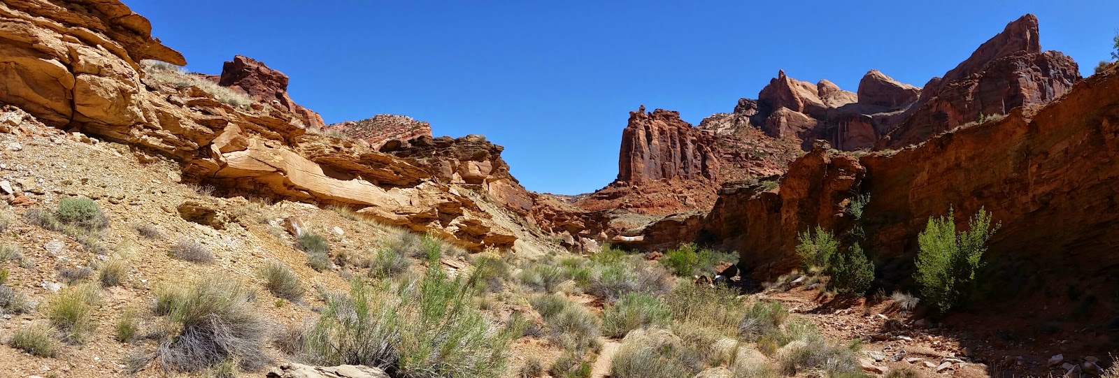
The more expansive views at Canyonlands, however, are unobstructable.  Sunset near the Green River Overlook was vast and hushed.  About ten years ago, I paddled through Canyonlands on the Green River for seven days.  It was nice to see a bird's-eye view of the textured canyons draining the winding miles of water too thin to plow, too thick to drink.


Besides standing in awe of the big overlooks, I hiked down over 1,300 feet and 8.5 miles around a formation called the Upheaval Dome.  At several points, the trail required some creative moves with both hands and both feet.


A short, but steep hike into the Ute Canyon at Colorado National Monument got me ready for the Upheaval Dome hike.  The lush stream bed provided a nice contrast to the ruddy sandstone of the plateaus.


The most terrifying canyon of all was the Black Canyon of the Gunnison.  I was afraid of falling off the edge and constantly nagged my fellow hikers to be careful.   I was so paranoid that I kept imagining the rental car rolling over the edge.  It was my second visit to the Black Canyon, but my first time to the more remote and primitive north rim.


I've always been fascinated by grouse, and since I was going to be in the West in April, I looked for an opportunity to see the mating dance of sage-grouse on the lek.  We joined a group led by Professor Patrick Magee a biologist at Western Colorado State University to observe the rare Gunnison Sage-Grouse.  He made a presentation the night before on the life history and conservation of the Gunnison Sage-Grouse, then took our group to a lek before sunrise.  As the sun crept over the ridge in the distance, we could see the sillouette of a male grouse shaking his head and tossing his long filo-plumes over his head to attract the attention of a mate.  Since all the grouse were about a kilometer away, I am sharing a 2011 web photo by Noppadol Paothong, I believe.


If the grouse were too far away for me to photograph, my luck changed when I spotted a bobcat in a roadside tree on my way to the Black Canyon.  At first my eye saw a squirrel's nest, but when it moved, I thought it was a porcupine.  As I approached the tree, I was thrilled to see my first bobcat in the wild.


Thursday, September 4, 2014

Glacier National Park 2014

When Glacier National Park was established in 1910, there were 150 glaciers within the park's one million acres in northwestern Montana.  As of summer 2014, there are only 25.  Rangers are not concerned that the glaciers are melting but they are alarmed by the rate at which they are disappearing.  They predict that all of the glaciers will be gone from the park by 2020 (only 6 years from now), which is why I am glad I went to the park while it is still possible to see a few of its chilly namesakes, such as the Jackson Glacier.

This was a fairly rugged trip, involving 2 weeks of tent camping and about 75 miles of hiking and backcountry backpacking.  Such efforts were greatly rewarded.  Here's an early morning view to the east of the Continental Divide at Gunsight Pass after a 3-mile hike rising 1,600-feet from Gunsight Lake.


The trail was quite narrow and steep in some places, since it is not much more than a goat trail.  Mountain Goats are king at the "Crown of the Continent," and one learns to give them room on the trail. 

     
A ranger-led hike to the Grinnell Glacier was another highlight.  In this picture, you can see three glaciers: Gem Glacier (atop the ridge to the left shrouded by the cloud), Salamander Glacier (cradled in the mountain to the right), and Grinnell Glacier (laying along the shore of Upper Grinnell Lake).  Salamander used to be joined with Grinnell, but melting has created two separate glaciers for now. 

 
One of the animals I have wanted to see all my life is Bighorn Sheep.  I have seen flocks of white Dall's Sheep in Alaska, but finally at Glacier a little boy's dream came true on the hike up to the Grinnell Glacier.  Climate change is shrinking alpine meadow habitat for wild sheep.
 

The hike returning to the Many Glacier Valley was breathtaking but bittersweet.  The source of the beautiful waterfall and milky blue waters of Grinnell Lake is meltwater from the glaciers.

Glacier is one of the last places in the U.S. to see wild Grizzly Bears.  Loud hiking and smart food storage prevented me from seeing any Grizzlies on this trip (which is just fine, thank you). 
A day hike to the Ptarmigan Pass brings you to a tunnel that was blasted through the rock in 1931. 


If you go through the tunnel, there is a gorgeous view of Elizabeth Lake to the west. 


Waterton Lakes National Park in Alberta, Canada, is a sister park to Glacier.  The staff at the historic Prince of Wales Hotel serves high tea in the afternoon, and it comes with a majestic view.